
Trace a Broken Arrow Street Address
A street address gives a practical starting point for a Broken Arrow address search. The record sequence is important because the city crosses Tulsa and Wagoner counties. Ownership information comes from county records, and a name connected to an address may represent a recorded party, a tax or mailing field, a voter registration context, or a historical directory appearance. Those are not interchangeable descriptions of a current household.
- Enter the address in the Broken Arrow GIS and use the parcel and boundary display to verify municipal status and county.
- Use the correct county assessor to note the account or parcel ID, situs address, legal description, and displayed owner or mailing field.
- Search the matching County Clerk deed index by parcel, legal description, or name, then note whether an image is available.
- Use the individual Oklahoma Voter Portal only when the required name and date of birth are available; record its date and privacy limits.
- Compare an older name or street with a dated criss-cross directory, Ledger item, map, or archive record.
The street-by-street path should stop when the source no longer supports the claim. A parcel record may confirm land information. It does not by itself establish who currently occupies a place.
Check Broken Arrow Street County
Broken Arrow must be routed as a two-county city. Tulsa County is the larger western and northern records environment. Wagoner County covers eastern and southern portions. Neither a Broken Arrow mailing city nor a ZIP code is enough to choose the assessor, County Clerk, court clerk, or election board. The city GIS is the useful first check because it has address points, parcels, and boundary layers.
Use the Broken Arrow GIS viewer to identify the location, then preserve the account number, parcel ID, and legal description for the county search. The city’s zoning-map book divides Tulsa County and Wagoner County sheets, which is another routing aid. A tax or property record should retain the county route rather than derive it from postal information.
Broken Arrow Street Parcel Fields
Tulsa County Assessor uses one broad search box for an address, account, subdivision, or owner, followed by an All filter, Search, Clear, quick tips, and result-column filtering. Begin with less detail. The published tips say to avoid periods, commas, and apostrophes, and allow quoted or negative terms to refine a query. A Tulsa parcel card can show site and mailing address, owner, parcel ID, land and improvement fields, school district, legal description, tax values, notice date, and sales or deed rows.
The Tulsa County parcel-card example shows the fields an address researcher should record, without treating the displayed sample as a Broken Arrow result.
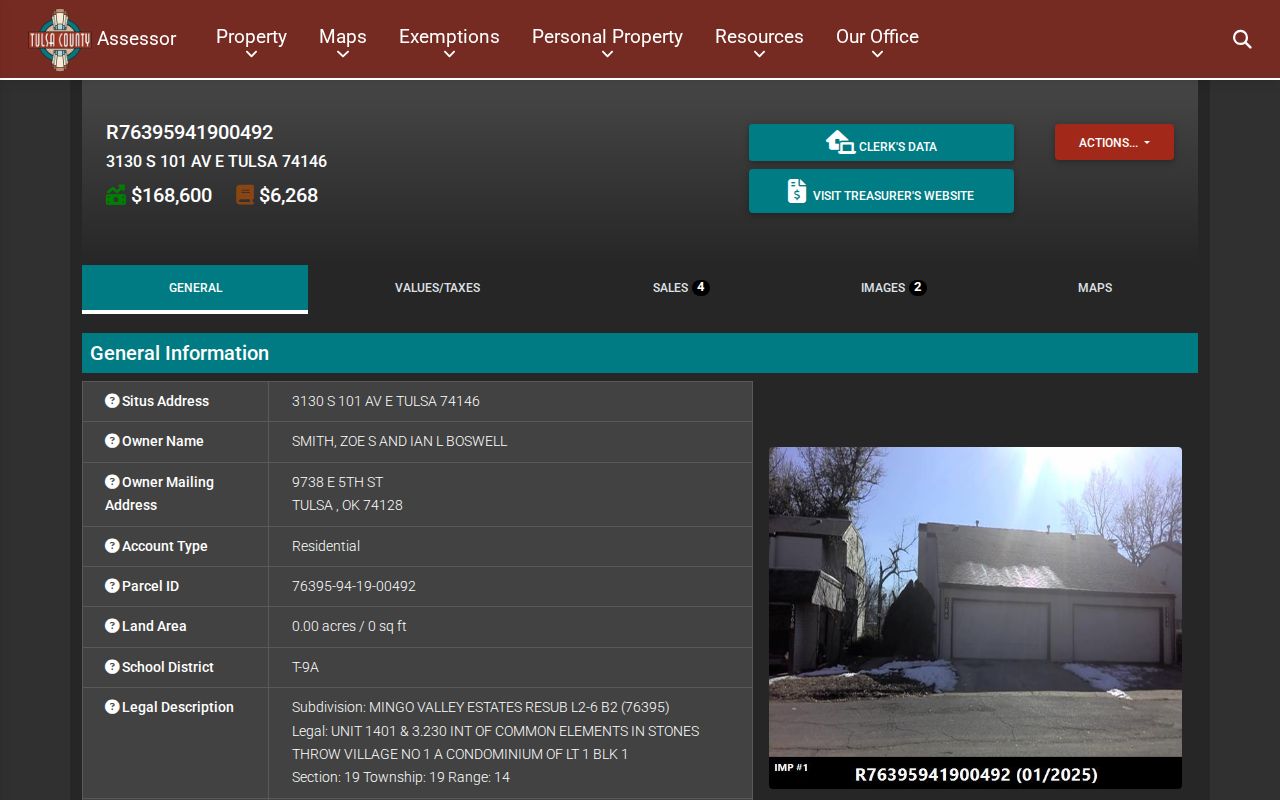
The assessor states that it is not the legal repository of ownership and the data may not be fully current. Use the card to bridge the address to the legal description and recorded index. The County Clerk’s instrument is the title evidence.
| Portal field or control | Address-search use |
|---|---|
| Broad search text | Enter an address, account, subdivision, or owner. |
| All filter | Start broad before narrowing a result set. |
| Result-column filtering | Compare sites and names after the first search. |
| Account or parcel ID | Carry the stable identifier to the deed index. |
| Legal description | Cross-check the parcel against the recorded land trail. |
Map a Broken Arrow Street Parcel
The municipal GIS is a locational tool, not a deed repository. Its address points, parcels, and city boundary help establish what address to search and where the county handoff occurs. The ArcGIS service supports Identify and Query operations and has a maximum record count of 2,000. Its zoning layer can display zoning code and description, ordinance, zoning case, document, purpose, permitted uses, dimensional standards, parking, signs, and edit dates.
Those map fields give place context, but zoning does not prove ownership or current occupancy. For a street-address record, capture the map source, layer or sheet, update date, visible boundary, parcel or account, and access date. Then compare the parcel’s legal description with the assessor and County Clerk entries. Wagoner GIS requires a login and calls itself a mapping aid, so plats and deeds remain the authoritative land records.
Search Broken Arrow Deed Parcels
For a Tulsa County address, Tulsa Acclaim provides a parcel-oriented route into recorded land records. Its parcel form has a Parcel # text field, Starts With, Contains, and Exact choices, a Document Type dropdown, From Date and To Date fields, plus search and reset controls. That structure works best after the assessor or GIS has supplied a parcel number and legal description.
The Tulsa Acclaim parcel search displays the parcel, document-type, and date controls used for a Broken Arrow street search.
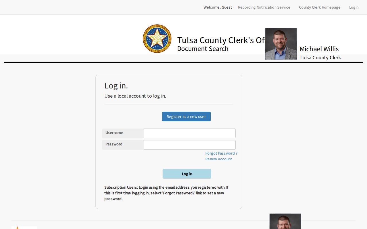
Use the date range to separate records from different periods, then compare grantor or grantee names, recording dates, and legal descriptions. A parcel key links records more reliably than a street label that may have changed.
Broken Arrow Street Deed Coverage
Tulsa County procurement material documents name searching from 1928 to current and legal-description searching from 1987 to current. A current-index notice was verified through February 4, 2026. The Acclaim landing page also offers name, document number, book or page, record date, consideration, subdivision or condo, section-township-range, parcel, case number, and alpha-index routes. That breadth lets an address search move from current parcel clues toward an older recorded name trail.
The Tulsa Acclaim land-record index shows the record-search choices available for a Tulsa County Broken Arrow address query.
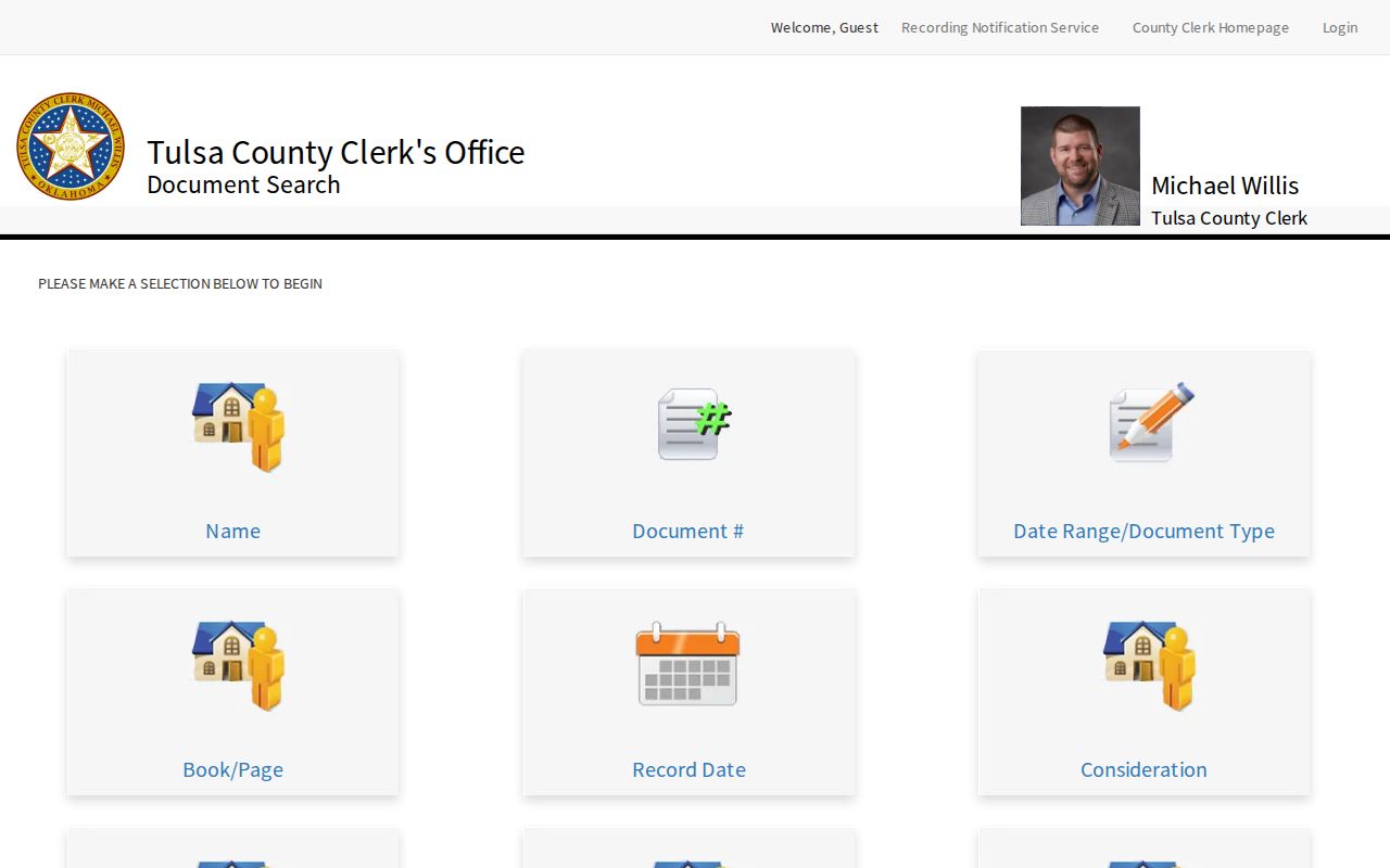
Index access and document-image access are not the same. The search page may return an access notice or require an account for images, and historical-camera material has separate conditions. Record whether a result is index-only or includes an image. Note: An indexed party name does not prove a present connection to the street.
Route Wagoner Broken Arrow Streets
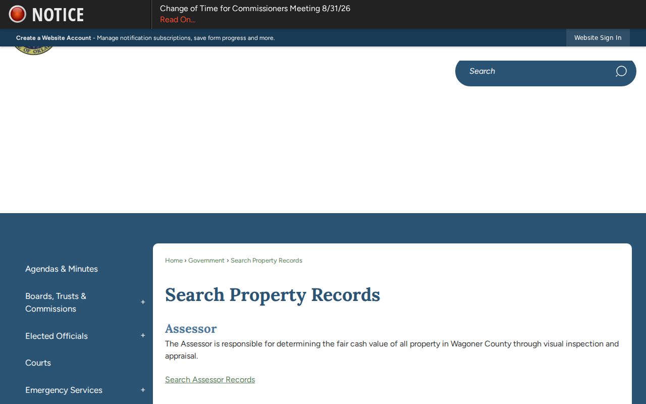
Eastern and southern Broken Arrow parcels may belong in Wagoner County. The county property-records page leads to assessor, clerk, and treasurer routes, and the official assessor portal is Spatialest. The automated inspection did not expose its public search fields, so a user should verify the live interface or contact the assessor instead of assuming that Tulsa search controls apply. Wagoner County Clerk land records are the recorded-document authority.
The Wagoner County property-records gateway is the correct starting point when the city GIS places a Broken Arrow street in Wagoner County.
The Wagoner County Clerk promotes Eagle Fraud Guard email alerts and warns about a solicitation seeking $86 for a deed copy when a county certified copy costs $2 per page. An alert signals a filing; it does not certify title, establish occupancy, or authenticate a caller.
Broken Arrow Address Record Sources
Street records work as a chain, not as a single listing. Each source below is keyed to an address, parcel, legal description, or a dated street string. The table keeps the record role clear so an official property display is not confused with a historical directory or individual voter context.
| Address source | Keeper | What it can show | Access condition |
|---|---|---|---|
| City GIS | City of Broken Arrow | Address point, parcel, city boundary, and map context | Public map viewer |
| Assessor parcel card | Tulsa or Wagoner assessor | Parcel identifiers and displayed property fields | County route required |
| Recorded land index | Matching County Clerk | Instrument parties, dates, and legal description | Index and image conditions differ |
| Individual voter lookup | Oklahoma Election Board | Registration context for a verified individual | Name and date of birth required |
| Directory or newspaper | Library, archive, or Gateway | Dated street and household clue | Historical scope varies |
The parcel identifier can tie the property index to deed work; the legal description is often the best cross-check across renamed streets. The street name ties historical sources together only after its original and current forms are compared.
Translate Broken Arrow Street Names
Broken Arrow formally adopted its current street-numbering system in 1973. Older sources can use a different version of the same street. The downtown grid used lettered avenues. E Avenue became Broadway, and 2nd Street became Main. College was formerly Avenue D; Commercial was Avenue F before the 1910 College Addition. Preserve the source’s original street string beside the normalized search form.
Crosswalks also matter on major corridors: Azalea or Mingo corresponds to 129th E, Olive or 129th E to 145th E, Elm to 161st E, 9th or Lynn Lane to 177th E, and 23rd or County Line to 193rd E. The city street-name history is the source for checking old and current forms. Search both terms in a Ledger or directory before deciding a result belongs to the same street.
- Parcel
- A mapped land unit with an assessment identifier.
- Situs address
- The physical address shown for the property, not necessarily a mailing field.
- Plat
- A recorded map that lays out a subdivision or parcel arrangement.
- Criss-cross directory
- An address-arranged historical directory useful for a dated street trace.
Check Broken Arrow Street ZIPs
Broken Arrow postal use includes 74011, 74012, 74013, and 74014. The first two are primarily Tulsa County areas, while 74013 and 74014 reach eastern and southern areas where the Wagoner route and city boundary need confirmation. Postal city is not municipal status, and ZIP is not county proof. A land search should never be routed by ZIP alone.
For an address near a city edge, retain three facts separately: postal city, municipal status, and county. That small check also helps with annexation questions. A parcel can have a Broken Arrow mailing address while lying outside the incorporated boundary, and a recorded legal description remains more important than a changed postal label.
Read 1905 Broken Arrow Streets
The 1905 Sanborn fire-insurance map and early Broken Arrow Ledger make a dated story layer for the original townsite. The Library of Congress map from March 1905 has two sheets and can show building footprints, construction materials, use, and named streets. It is evidence of what appeared on that map date, not continuous evidence about a parcel or person.
Gateway’s Broken Arrow Ledger collection includes 106 issues and 867 pages in its early run, with online examples from 1904 through 1906. Later holdings include 1925-1979 material and a limited 1960 digital run, not a full continuous newspaper series. The Oklahoma Historical Society home-history approach moves from assessor and County Clerk records to directories, Sanborn maps, newspapers, and old address or name combinations.
Search old and current street forms, spouse names, institution names, subdivision names, and legal-description fragments. Cite the issue date and page, then match an older location to the modern parcel with care.
Limit a Broken Arrow Street Search
A Broken Arrow address search cannot establish an unbroken present-day roster for a street. Assessor fields can lag and the tax mailing field has its own purpose. Deed parties are tied to instruments. Voter information is subject to individual lookup rules and protected-address suppression. Historical directories, maps, and newspapers are dated sources. Driver-license personal information is restricted under the federal DPPA, and sealed, juvenile, medical, vital, or protected information may be unavailable.
When a result is absent, record the system, date, search terms, filters, and any login, image, or coverage limitation. Do not turn an unavailable result into a claim that no record exists or that a person has no connection to the street.
Lawful use. Use Broken Arrow address records for personal, lawful research, property history, family history, or civic questions. Do not use an address trail to stalk, harass, intimidate, or harm anyone.